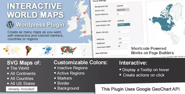
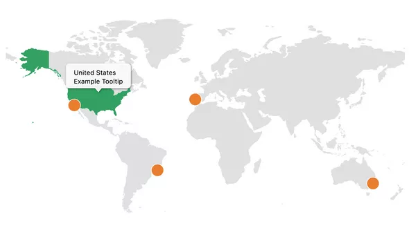
This is a Wordpress plugin to create as many maps as you want, with interactive and colored markers, continents, countries or regions.
Show Different Regions
You will be able to show hundreds of different kinds of maps, already included:
- A map of the entire world.
- A continent or a sub-continent. (Africa, Europe, Americas, Asia, Oceania and all their sub-continents)
- A country. (virtually all the countries in the world are included, featuring the most requested: USA, United Kingdom, Canada, France, Germany, Spain, Italy, Brazil, India, Australia…)
- A country divided by its regions. *
- A state in the United States.
- The United States divided by metropolitan areas.
- A state in the United States divided by metropolitan areas.
Related articles
Nov 17, 2023
Interactive Geo Maps Pro

Sep 23, 2025
Super Interactive Maps for Wordpress

Aug 31, 2022
Mapper - Interactive World Map for Elementor
Mar 03, 2024
Country State City Dropdown Pro

Mar 22, 2025
Amazomatic - Amazon Affiliate Post Importing Money Generator Plugin for WordPress

Jul 11, 2023
WP Full Pay - Stripe Payments Plugin for WordPress

Apr 11, 2026
MapSVG - Google Maps, Vector Maps, Image Maps, and Store Locator for WordPress

Apr 29, 2022
CM Map Locations Pro
Add comment
Information
Users of Visitors are not allowed to comment this post.
No comments
Leave a comment